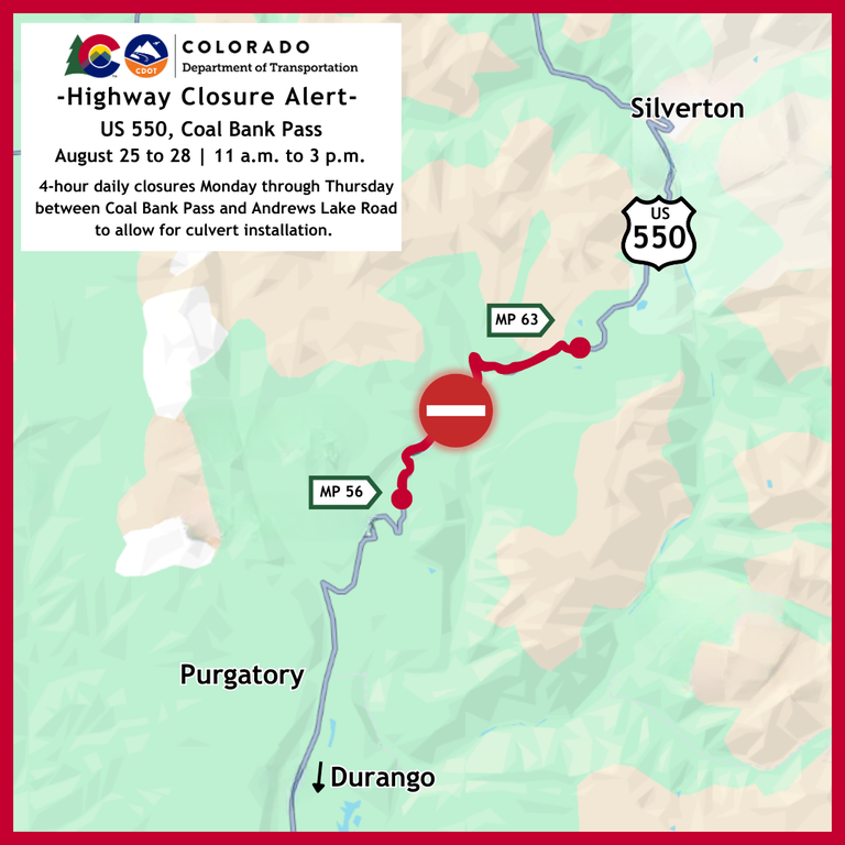
Daytime full road closures scheduled to take place Aug. 25 to 28 on US 550 Coal Bank Pass
Travel Advisory

Southwest Colorado — US Highway 550 between Durango and Silverton will experience full road closures in both directions Aug. 25 through Aug. 28 from 11 a.m. to 3 p.m., each day. Northbound motorists will be stopped just north of the Coal Bank Pass overlook and Pass Creek trailhead (Mile Point 56.6). Southbound traffic will be stopped at Andrews Lake Road (Mile Point 63). This daily four-hour closure will allow crews to safely and efficiently install a new culvert under the roadway near the summit of Coal Bank Pass. Access to Pass Creek/Engineer Mountain trailhead parking area, the Coal Bank Pass overlook and restrooms will remain open.
Motorists should plan accordingly and schedule all travel around the set closure times or consider the alternate north-south route via Colorado Highway 145 through Telluride. Additionally, motorists can continue to expect full stops and up to 20-minute delays at both traffic signal locations between Mile Point 56 and MP 60 throughout the duration of the project.
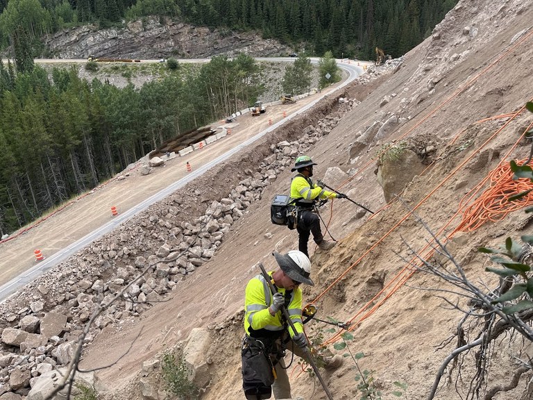
Since starting work on the US 550 Rockfall Mitigation and Wall Replacement project on May 12, crews have conducted slope excavation, rock removal work, and have begun exporting the excavated material to a stockpile location at the pull-out near Andrews Lake (MP 62.7).
Work to stabilize and reinforce the sub-grade under the roadway at the Coal Bank (Mile Point 56.9) just north of Engineer Mountain Trailhead is complete. Crews are now installing a culvert and constructing a new retaining wall structure underneath the highway.
Project Information
For additional information about this project:
- Call the project information line at 970-718-5148
- Email the project team at: [email protected]
- Visit the project website at: codot.gov/projects/us550wallreplacement

Know Before You Go
Travelers are urged to “know before you go.” Gather information about weather forecasts and anticipated travel impacts and current road conditions prior to hitting the road. CDOT resources include:
- Road conditions and travel information: COtrip.org
- Download the COtrip Planner app: bit.ly/COtripapp
- Sign up for project or travel alerts: bit.ly/COnewsalerts
- Check scheduled construction lane closures: bit.ly/laneclosures
- Connect with @ColoradoDOT on social media: X, Facebook, Instagram and YouTube
Remember: Slow For The Cone Zone
The following tips are to help you stay safe while traveling through maintenance and construction work zones.
- Do not speed in work zones. Obey the posted speed limits.
- Stay Alert! Expect the unexpected.
- Watch for workers. Drive with caution.
- Don't change lanes unnecessarily.
- Avoid using mobile devices such as phones while driving in work zones.
- Turn on headlights so that workers and other drivers can see you.
- Be especially alert at night while driving in work zones.
- Expect delays, especially during peak travel times.
- Allow ample space between you and the car in front of you.
- Anticipate lane shifts and merge when directed to do so.
- Be patient!
Download the COtrip App!
The new free COtrip Planner mobile app was designed to meet the growing trend of information on mobile and tablet devices for the traveling public. The COtrip Planner app provides statewide, real-time traffic information, and works on mobile devices that operate on the iOS and Android platforms. Visit the Google Play Store (Android devices) or the Apple Store (iOS devices) to download!
