
Ongoing closure of US 550 Red Mountain Pass due to mud, debris removal efforts
Travel Advisory
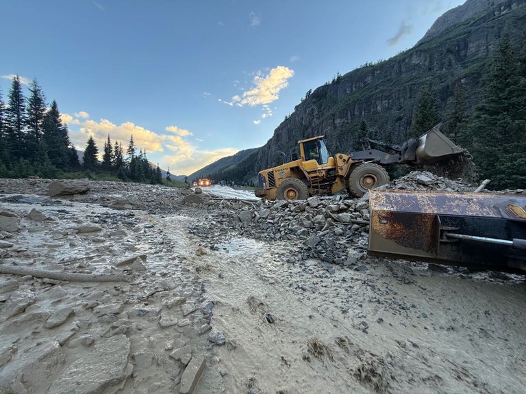
San Juan County — US Highway 550 between Silverton and Ouray is expected to remain closed through the evening, Thursday, July 30, as the Colorado Department of Transportation crews clear debris from several mud and rock slides that crossed the highway. Severe rains and flooding impacted US 550 Red Mountain Pass prompting an extended closure which began at 7:30 p.m. on Wednesday evening and is expected to continue through Friday.
US 550 is closed to all traffic including motorists accessing the highway from 4X4 roads, access roads and trails. Backcountry recreationists within the closure area are encouraged to shelter in place if possible. Stranded visitors seeking shelter or assistance can contact the San Juan County Sheriff's Office, Colorado at 970-387-5531.
During this extended closure, motorists may consider the westerly alternative route via CO 145 through Telluride. Motorists are urged to avoid rugged off-road, four-wheel drive and 4x4 detours or unpaved "shortcuts" suggested by digital map apps.
Motorists are encouraged to check the most current traffic impacts on COtrip.org or download the COtrip Planner app.
Closure Locations
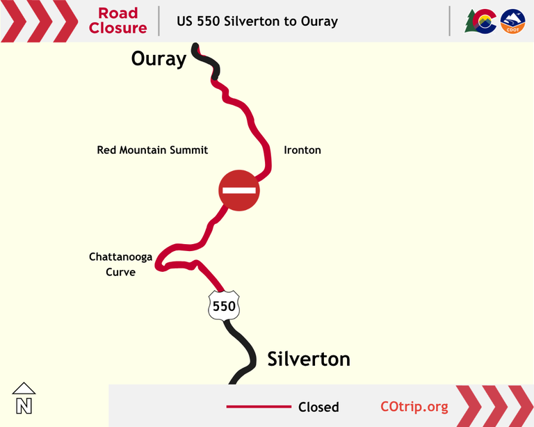
Motorists will encounter full closures in both directions, with no exact times of reopening.
- Northbound travelers will encounter a closure approximately five miles north of Silverton near Ophir Pass Road (Mile Point 75.2)
- Southbound travelers will encounter a closure at the Bear Creek Overlook, approximately three miles south of Ouray (MP 90.9)
- Do not attempt to pass closed gates or access the highway from 4X4 roads, access roads or trails
Alternative Routes
Drivers may consider an alternate route via CO 145 through Telluride. This westerly route will add approximately one hour of additional driving time, taking approximately three hours from Durango to Telluride and ending in Ridgway (approximately 150 miles).
- US 160 Durango to Mancos
- CO 184 Mancos to Dolores
- CO 145 Dolores to Placerville
- CO 62 Placerville to Ridgway
Know Before You Go
Travelers are urged to “know before you go.” Gather information about weather forecasts and anticipated travel impacts and current road conditions prior to hitting the road. CDOT resources include:
- Road conditions and travel information: COtrip.org
- Download the COtrip Planner app: bit.ly/COtripapp
- Sign up for project or travel alerts: bit.ly/COnewsalerts
- Check scheduled construction lane closures: bit.ly/laneclosures
- Connect with @ColoradoDOT on social media: X, Facebook, Instagram and YouTube
Remember: Slow For The Cone Zone
The following tips are to help you stay safe while traveling through maintenance and construction work zones.
- Do not speed in work zones. Obey the posted speed limits.
- Stay Alert! Expect the unexpected.
- Watch for workers. Drive with caution.
- Don't change lanes unnecessarily.
- Avoid using mobile devices such as phones while driving in work zones.
- Turn on headlights so that workers and other drivers can see you.
- Be especially alert at night while driving in work zones.
- Expect delays, especially during peak travel times.
- Allow ample space between you and the car in front of you.
- Anticipate lane shifts and merge when directed to do so.
- Be patient!
Download the COtrip App!
The new free COtrip Planner mobile app was designed to meet the growing trend of information on mobile and tablet devices for the traveling public. The COtrip Planner app provides statewide, real-time traffic information, and works on mobile devices that operate on the iOS and Android platforms. Visit the Google Play Store (Android devices) or the Apple Store (iOS devices) to download!
