CO 82 at Independence Pass closes for the winter season
Travel Advisory
Lake and Pitkin Counties - As of Nov. 3, the Colorado Department of Transportation has closed Colorado Highway 82 over Independence Pass between Aspen and Twin Lakes for the 2026-2027 winter season.
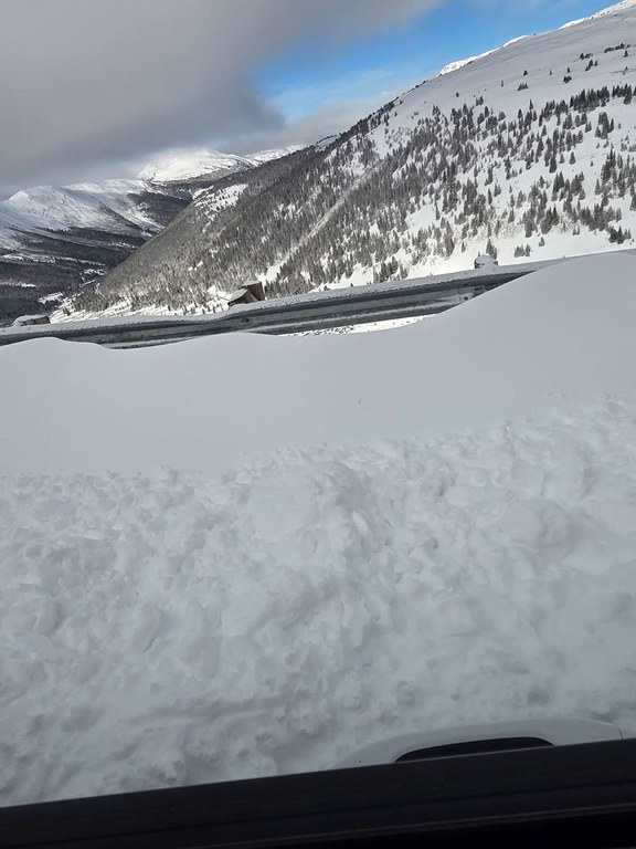
CDOT originally closed the pass temporarily on Saturday, Oct. 31, due to safety concerns surrounding a winter storm that brought several inches of snow and windy, hazardous conditions on the pass, but have now extended the closure into the seasonal closure due to the amount of snowfall and additional storms projected for the region.
During the seasonal closure, motorists traveling to Aspen from the Denver Metro area must use westbound Interstate 70 to Glenwood Springs, then travel south on CO 82 to Aspen. Independence Pass closure gates near Aspen and Twin Lakes will remain closed until CDOT reopens the pass next spring, typically around the Memorial Day holiday weekend, weather permitting.
This annual seasonal closure is essential for ensuring the safety of maintenance equipment operators and the traveling public during winter. Plowing the steep switchbacks on CO 82 is unsafe during the winter months due to severe avalanche hazards along key sections of the corridor.
“This morning our maintenance teams conducted an assessment of Highway 82 at Independence Pass and found significant snow drifts blocking the roadway, making it hazardous for travel,” said CDOT Regional Transportation Director Jason Smith. “Looking at those drifts, the prediction for several more inches of snow in the next storms and on the advice of our partners at the Colorado Avalanche Information Center, we made the decision to close the pass for the season. We try to keep it open as long as possible, but the decision to close the pass is for the safety of the traveling public and our CDOT crews.”
Independence Pass typically closes in late Oct. or early Nov., depending on weather conditions.
Recent Closure History
- 2020 - Nov. 13
- 2021 - Oct. 28
- 2022 - Nov. 4
- 2023 - Oct. 30
- 2024 - Oct. 31
- 2025 - Nov. 17
About Independence Pass
A designated Colorado Scenic and Historic Byway, Independence Pass is the highest paved state highway in Colorado, crossing the Continental Divide at 12,095 feet. Although paved, the road is narrow and curvy in many sections making driving conditions challenging. The route includes steep drop-offs and several stretches that can accommodate only a single vehicle, requiring drivers to use caution and remain alert when encountering oncoming traffic.
The summit of Independence Pass is located 18 miles west of Twin Lakes and 19 miles east of Aspen, crossing the Continental Divide through the Sawatch Range. The pass stretches 32 miles of mountainous terrain, winding through San Isabel National Forest on the east side and White River National Forest on the west.
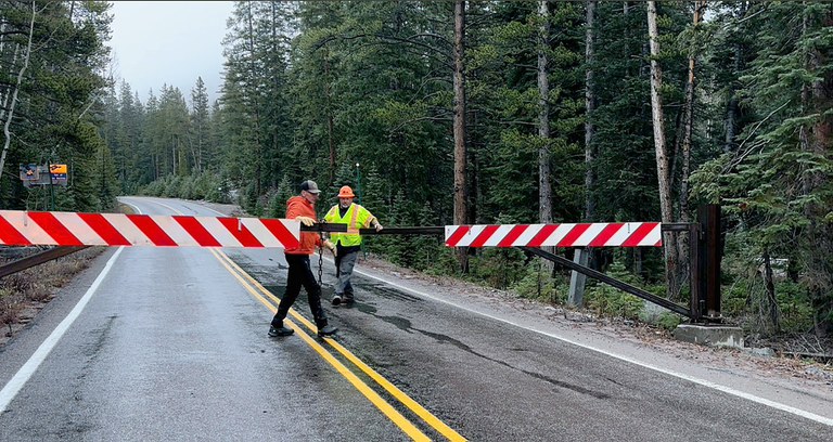
Independence Pass will remain closed at the Lincoln Creek Gate until after Nov. 15, when the third hunting season closes and then will be closed at the traditional gate located at Mile Point 47.25.
Know Before You Go
Travelers are urged to “know before you go.” Gather information about weather forecasts and anticipated travel impacts and current road conditions prior to hitting the road. CDOT resources include:
- Road conditions and travel information: COtrip.org
- Download the COtrip Planner app: bit.ly/COtripapp
- Sign up for project or travel alerts: bit.ly/COnewsalerts
- Check scheduled construction lane closures: bit.ly/laneclosures
- Connect with @ColoradoDOT on social media: X, Facebook, Instagram and YouTube
Remember: Slow For The Cone Zone
The following tips are to help you stay safe while traveling through maintenance and construction work zones.
- Do not speed in work zones. Obey the posted speed limits.
- Stay Alert! Expect the unexpected.
- Watch for workers. Drive with caution.
- Don't change lanes unnecessarily.
- Avoid using mobile devices such as phones while driving in work zones.
- Turn on headlights so that workers and other drivers can see you.
- Be especially alert at night while driving in work zones.
- Expect delays, especially during peak travel times.
- Allow ample space between you and the car in front of you.
- Anticipate lane shifts and merge when directed to do so.
- Be patient!
Download the COtrip App!
The new free COtrip Planner mobile app was designed to meet the growing trend of information on mobile and tablet devices for the traveling public. The COtrip Planner app provides statewide, real-time traffic information, and works on mobile devices that operate on the iOS and Android platforms. Visit the Google Play Store (Android devices) or the Apple Store (iOS devices) to download!
About CDOT
The Colorado Department of Transportation’s mission is to provide the best multi-modal transportation system that most effectively and safely moves people, goods and information. CDOT maintains more than 23,000 lane miles of highway, more than 3,400 bridges and 35 mountain passes. Our team of employees works tirelessly to reduce the rate and severity of crashes and improve the safety of all modes of transportation. CDOT leverages partnerships with a range of private and public organizations and operates Bustang, an interregional express bus service. Find more details at codot.gov.
