
Flooding and road closures impact southwest and south-central Colorado
Travel Advisory
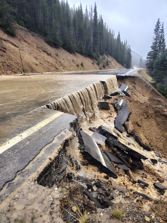
Southwest and South-Central Colorado - The Colorado Department of Transportation is urging motorists to avoid travel during the current flood warnings and flood watches issued for southwest and south-central Colorado. If you must travel, avoid driving through flooded areas and never drive through closure gates or barricades. Check the latest road conditions and traffic impacts on COtrip.org or on the COtrip Planner app.
Multiple full closures remained in place across southwest Colorado. Motorists should be prepared for additional safety closures in other areas of the region where significant flooding is creating roadway hazards. Safety closures may be extended due to weather conditions, water levels and highway damage.
Extended Safety Closures as of Oct. 23 at 8 a.m.:
- CO 17 (MP 0 to 38) Cumbres and La Manga Passes, from the New Mexico state line to Antonito
- CO 151 (MP 22 to 34) at Chimney Rock, from the US 160 junction to Arboles
- US 160 (MP 133 to 137) just west of Pagosa Springs from Deer Trail Road to Elk Canyon Ranch Road/Hersch Ave
- US 160 (MP 143) downtown Pagosa Springs at McCabe Creek, between 7th Street and Lewis Street
- US 160 (MP 157 to 183) Wolf Creek Pass from the west side of the pass at Treasure Falls chain up station to South Fork
- US 550 (Mile Points 75 to 80) Red Mountain Pass between Silverton and Ouray
Motorist Safety
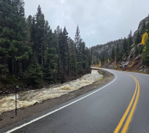
When motorists drive up onto a flooded area, there are several precautions to follow.
- Never drive through any flooded area, you do not know how deep or how fast the water is running
- If you are stuck on the roadway during a closure it is best to remain in your vehicle unless absolutely necessary
- Even eight to 10 inches of water can float an average-sized car, which can be easily swept off the road
- Driving too fast on wet roads or in flooded areas can cause a vehicle to hydroplane. Never use your cruise control during rainy conditions with standing water on the roadway
- Any amount of flooding or mud can obstruct the roadway and hinder drivers from knowing exactly where to drive. If you cannot see the roadway, be smart and wait for the water to subside
- Water and mud can contain unknown hazards hidden under the surface – rocks or other debris, like plant material and tree branches
Be Prepared
Highway closures can last for as little as a few minutes or for as long as several hours. When drivers set out on a trip, especially through high country roads, it is wise to have the car supplied with an emergency kit. The kit should contain at the very minimum: water, snacks, flashlight, and a blanket. Remember to also carry water for your pets if you’re traveling with animals. You may even consider packing some items to keep you or children occupied while waiting in the car. Activity books, colored pencils or a deck of cards can help pass the time.
Know Before You Go
Travelers are urged to “know before you go.” Gather information about weather forecasts and anticipated travel impacts and current road conditions prior to hitting the road. CDOT resources include:
- Road conditions and travel information: COtrip.org
- Download the COtrip Planner app: bit.ly/COtripapp
- Sign up for project or travel alerts: bit.ly/COnewsalerts
- Check scheduled construction lane closures: bit.ly/laneclosures
- Connect with @ColoradoDOT on social media: X, Facebook, Instagram and YouTube
Remember: Slow For The Cone Zone
The following tips are to help you stay safe while traveling through maintenance and construction work zones.
- Do not speed in work zones. Obey the posted speed limits.
- Stay Alert! Expect the unexpected.
- Watch for workers. Drive with caution.
- Don't change lanes unnecessarily.
- Avoid using mobile devices such as phones while driving in work zones.
- Turn on headlights so that workers and other drivers can see you.
- Be especially alert at night while driving in work zones.
- Expect delays, especially during peak travel times.
- Allow ample space between you and the car in front of you.
- Anticipate lane shifts and merge when directed to do so.
- Be patient!
Download the COtrip App!
The new free COtrip Planner mobile app was designed to meet the growing trend of information on mobile and tablet devices for the traveling public. The COtrip Planner app provides statewide, real-time traffic information, and works on mobile devices that operate on the iOS and Android platforms. Visit the Google Play Store (Android devices) or the Apple Store (iOS devices) to download!
