US 24 Corridor Improvements | Design Phase
About the Project
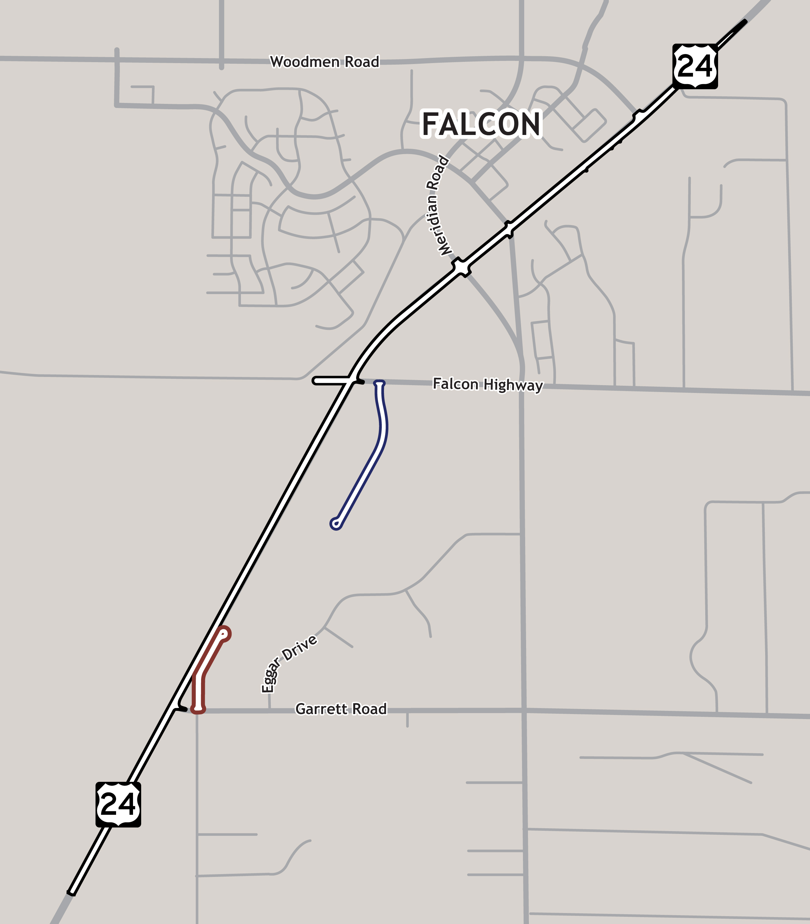
CDOT is currently developing the roadway design for US 24 between Garrett Road and Woodmen Road to enhance safety, improve operational performance, and reduce congestion. Improvements include adding one new lane in each direction and a widened median in this area. The roadway design will also include the improvement of several existing at grade intersections to accommodate the widened highway. For additional neighborhood safety, two local roads will be built to provide better access to the widened US 24. These are shown in the map below as a “backage” and “frontage” road options.
Schedule & Important Dates
- Right of Way Process Start: Fall 2025
- Construction Start: Summer 2027
Project Area
US Highway 24: Garrett to Woodman project area map that shows the project limits, the proposed Frontage Road Concept on the southern portion of the project area and the proposed Backage Road Concept off of Falcon Highway in the middle portion of the project area.

CDOT conducted a Planning and Environmental Linkages (PEL) study in 2018 to examine conditions and anticipated problem areas along the US 24 corridor in El Paso County, between Powers Boulevard (CO 21) and the Town of Ramah. The study identified a range of transportation improvements along the corridor and concluded that the area between Garrett and Woodman Trail is a high priority for additional lanes. This project will focus on adding features to improve travel and safety along this limited portion of the corridor as detailed in the project map.
US Highway 24 will be widened to two lanes in each direction with a median between Garrett and Woodman Road. In addition, a backage road, approximately a half mile in length, will be designed for construction to provide access to properties west of Falcon Highway. Dodge Rod will be extended approximate a quarter mile to provide access to properties east of Garrett Road.
At the Woodmen intersection a fourth leg Road is being designed for construction in coordination with a future-planned development South of US 24. This leg will provide commercial and residential access.
At Falcon Highway a fourth leg is being designed for construction to provide safe access for properties north of US 24.
CDOT conducted a Planning and Environmental Linkages (PEL) study in 2018 to examine conditions and anticipated problem areas along the US 24 corridor in El Paso County, between Powers Boulevard (CO 21) and the Town of Ramah. The study identified a range of transportation improvements along the corridor and concluded that the area between Garrett and Woodman Trail is a high priority for additional lanes.
As part of the PEL study, understanding the ideas, perspectives, and needs of the community and stakeholders in the corridor area was critical to building broadly supported decisions and solutions for the project. CDOT provided multiple opportunities for the local jurisdictions, regional partners, and the community to inform the study. Access the US 24 Planning and Environmental Linkages (PEL) Study for more information.
