
CO 46 Resurfacing in Gilpin & Jefferson Counties
About the Project
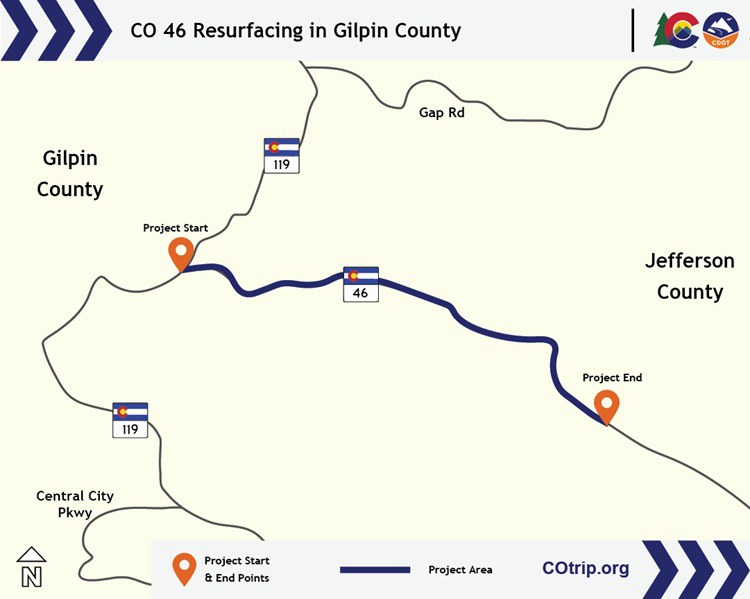
The project consists of milling and paving 6.6 miles of Colorado Highway 46 to provide a safe, smooth driving surface, adding new lane striping and wayfinding signs, and cleaning culverts for improved storm drainage runoff.
Project Facts
- Construction Cost: $2.6 million
- Contractor: Martin Marietta
- Timeline: September 2026 to October 2026
- Location: CO 46
- Nearest Town/City: Black Hawk
- Mile Point(s): MP 0 to MP 6.6
- Counties: Gilpin and Jefferson
Project Benefits
Goal is to improve safety and mobility along a two-lane highway in Gilpin County. Benefits include:
- Restoring the road surface to optimal condition
- Restriping and adding signs to improve safety and visibility
Work Schedule
- Project begins Sept. 1, 2026 with anticipated completion by Oct. 31.
- Work will be performed during daylight hours (15 minutes after sunrise to 15 minutes before sunset) Monday to Friday
- Expect some overnight work
Traffic Impacts
The following impacts can be expected during construction:
- Motorists can expect single daytime lane closures for up to one mile in length, with traffic holds up to 10 minutes, Monday to Friday
- Temporary access disruptions to private driveways, business entrances and approaches to and from side streets will exist in the first few weeks of the project
- Addresses can expect up to two days of impacts and 10-minute delays, managed by flagger operations
- During the Fall foliage season (Sept. 15 to Oct. 31), lane closure lengths will be reduced to half a mile
- Only one lane closure will exist at a time within the work zone
- Shoulder closures can be expected outside lane closure areas within the project limits
- Work will progress from east to west
- A 10-foot width restriction will be in place
- During lane closures, bicyclists traveling westbound (uphill) will be queued and permitted to clear the work zone before vehicles, followed by a pilot car
- Downhill bicycle traffic (eastbound) will be held by flaggers and only permitted to proceed through the work zone after the last vehicle has been released from the queue
- Access to the Blue Grouse Trail and Beaver Trail will be maintained at all times
- Reduced speeds can be expected
- Signs and construction devices will be present to alert motorists and bicyclists to lane closures, traffic shifts and other work zone restrictions
- Refer to COtrip.org for real-time travel conditions and road closures
