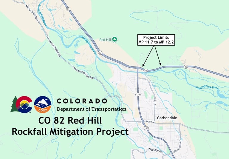
CO 82 Red Hill Rockfall Mitigation
Project Update/Status
A winter shutdown will begin for the rockfall mitigation along CO 82 at Red Hill on Nov. 7, 2025. A winter shutdown will be necessary to allow for safety conditions for workers and the traveling public due to adverse winter conditions. Crews will resume work spring of 2026.About the Project
Rockfall mitigation will take place near Carbondale on CO 82 at Red Hill from Mile Point 11.7 to MP 12.2, east of the CO 82/CO 133 intersection.
Work will include:
- Removal of loose rocks
- Mesh netting installation
- Culvert cleaning
Work this Week & Lane Closures on CO 82 at Red Hill
Project Facts
- Construction Cost: $1.6 million
- Contractor: Rock Supremacy
- Timeline: May 2025 to May 2026
- Location: CO 82 at Red Hill
- Nearest Town/City: Carbondale
- Mile Point(s): MP 11.7 to MP 12.2
- County: Garfield

Project Benefits
- Eliminate loose surface material on a cliff or slope
- Decrease the potential of rockfall hazard for motorists traveling on the highway
- The new post mounted mesh system will help capture potential falling rocks and debris and deposit them into the catchment ditch.
Work Schedule
- When work resumes motorist should plan for daytime work Monday through Thursday from 6 a.m. to 7 p.m. and Friday from 6 a.m. to 3 p.m.
Traffic Impacts
- Single-lane closures
- Speed reduction to 45 MPH
- 14-foot width restriction
- Occasional 20-minute traffic holds
- Refer to COtrip.org for real-time travel conditions and road closures
