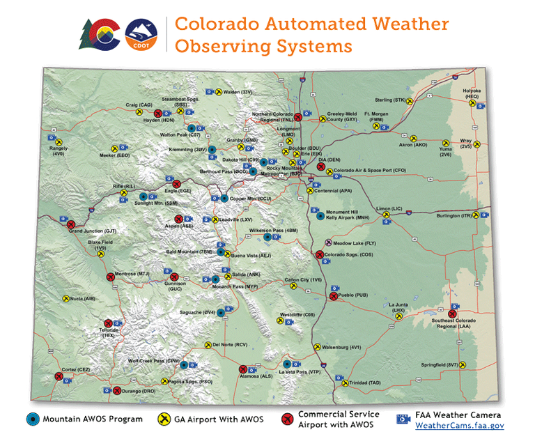
Automated Weather Observing System (AWOS) Program
During its 2000 session, the Colorado General Assembly acknowledged the need for improved aviation weather reporting in the mountainous terrain along the Continental Divide. With shared funding from the Legislature and the Colorado Aviation Fund, twelve Automated Weather Observing System (AWOS) sites were installed. These were sited at those critical mountain passes most vulnerable to weather-dependent aircraft accidents.
VIDEO: The video below was produced by the Colorado Division of Aeronautics and documents the many obstacles Colorado's Communications Technicians face with the task of repairing and maintaining our network of mountain automated weather observation systems. The Colorado Division of Aeronautics would like to pay special thanks to the technicians with the Governor's Office of Information Technology who work extremely hard to keep accurate mountain weather informations flowing out to the public.
Bald Mountain AWOS (7BM) *Near Cottonwood Pass
Berthoud Pass - Mines Peak AWOS (0CO)
Dakota Hill AWOS (C99) *Near Rollins Pass
![]() Kremmling-McElroy Field AWOS (20V)
Kremmling-McElroy Field AWOS (20V)
Monument Hill - Kelly Air Park AWOS (MNH)
Saguache Municipal Airport AWOS (04V)
