LALSR - Low Altitude Large Scale Reconnaissance
Equipment
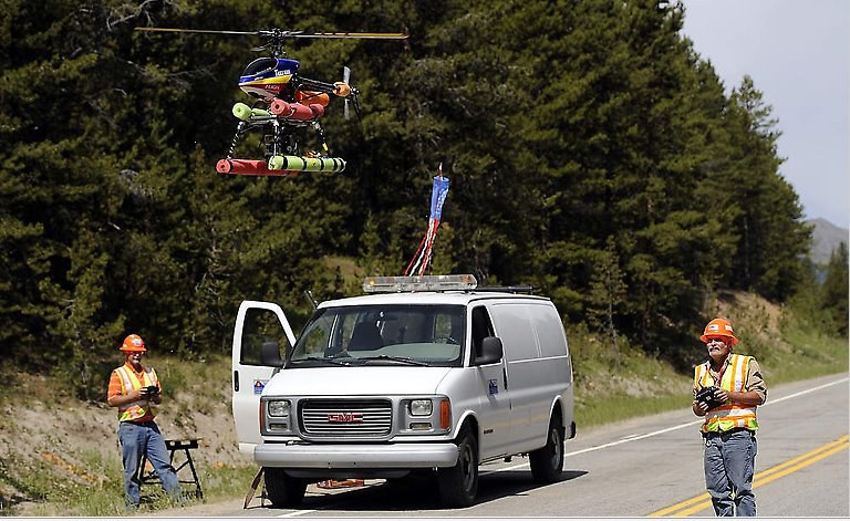
A 12-megapixel digital camera is mounted in an unmanned aerial vehicle (UAV) remote controlled (RC) aircraft. Pictures are taken remotely using sophisticated radio transceivers. The flight crew on the ground always has visual confirmation of the shots via a pilot's view, remote video camera as well as the digital camera mounted in a ball on the front of the aircraft. The digital ball video camera has the ability to assume any position either vertically or horizontally. This allows the flight crew to fly the plane remotely, even if they do not have visual contact with the plane from the ground. The digital ball camera can accommodate standard "vertical" aerials or an array of oblique shots.

The RC system is extremely versatile. The lightweight aircraft and supporting equipment is transported in a van that allows the crew to access almost any site, no matter how remote. The planes requires very little "runway" and "take-offs" from bridge decks, frontage roads and even by hand launching have all been successfully accomplished. Landings also require little in the way of space.
The LALSR groups use of radio-controlled aircraft for aerial photography is significant because it provides an inexpensive way to acquire quality, large scale photographs. The need for timely, high-quality photos of quickly changing construction sites, landslide areas, rockfall locales, etc., is great, and the CDOT/LALSR group has engineered a unique and cost effective solution for these needs. The use and cost savings have successfully allowed a wide array of new applications:
- Engineering
- Historical Changes
- Erosion Control
- Planning Studies
- Topographic Mapping
- Construction Progress
- Land Use
- Hydrologic Studies
- Timber Studies
- Geologic Studies
- Legal Disputes
- Environmental Impact Studies
- Public Relations
- Wetland Studies
- Geotechnical Studies
- GPS/GIS Background Maps
Photographs
Bighorn Sheep Canyon.
Colorado Highway 58 and I-70.
Book Cliffs in Palisade on I-70.
Red Mountain Pass.
