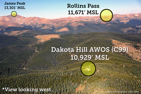
Dakota Hill Automated Weather Observing System (AWOS) C99
The Dakota Hill Automated Weather Observing System (AWOS) is located on the summit of Dakota Hill, north-northwest of Central City, and approximately 7 miles east of Rollins Pass at an elevation of 10,938' MSL.
| Latitude | Longitude | Frequency | Phone |
|---|---|---|---|
| N39° 52' 8" | W105° 33' 12" | 134.175 | 303-512-4421 |
Current Conditions at Dakota Hill
FAA Weather Camera View & Weather Information
Location Map of Dakota Hill AWOS
Aerial Photo of Dakota Hill AWOS

