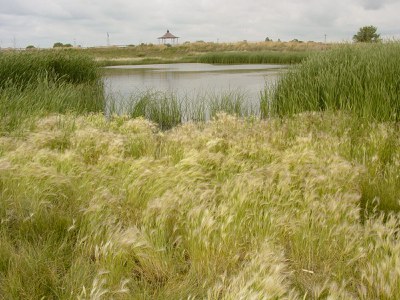
Wetland Mitigation
Wetland Banking
CDOT uses several commercial wetland banks throughout Colorado. A current list of wetland mitigation banks and their status can be found on the Regulatory In-lieu Fee and Bank Information Tracking System (RIBITS) developed by the U.S. Army Corps of Engineers. Click on the link for RIBITS, then click on "Advanced" or "Continue to this website", and choose the link for RIBITS again, if necessary. The Department of the Army website is safe.
Active Commercial Wetland Banks in Colorado
The following is a list of commercial wetland mitigation banks currently available for use on CDOT projects:
Animas River Wetlands
Primary service area = Animas River watershed
- Tier 1 (primary service area)
- HUC 14080104, state boundary to 8,500'
- HUC 14080101 western branch (Los Piños River) from State Line to 8,500'
- Tier 2 (secondary service area)
- HUC 14080107 (Mancos River) to 8,500'
- HUC 14080102 (Piedra River) to 8,500'
- Tier 3 (tertiary service area)
- HUC 14080101 eastern branch (Upper San Juan) from State Line to 8,500'
Finger Rock Preserve
Primary service area = Upper Yampa River watershed (HUC 14050001), Brinker, and Chimney creeks.
Maria Lake Mitigation Bank
Primary service area = All of Prowers, Bent, Otero, Crowley, and Kiowa counties and parts of Huerfano, Pueblo, Fremont, El Paso, Elbert, Lincoln, Cheyenne, and Las Animas counties.
Big Thompson Confluence Mitigation Bank
General Service Area = Portions of the Middle South Platte-Cherry Creek HUC 10190003 and the Big Thompson HUC 10190006, as well as portions of adjoining 8-digit HUCs within the USACE Omaha District Regulatory Boundary. At the discretion of the US Army Corps of Engineers, credits may be approved outside of the primary geographic service area.
Front Range Mitigation Bank
General Service Area = Middle South Platte-Sterling (HUC 10190012), the Middle South Platte-Cherry Creek (HUC 10190003), Lower South Platte (HUC 10190012), Lower Lodgepole (HUC 10190016), Pawnee (HUC 10190014), Sidney Draw (10190017), Beaver (HUC 10190013), Crow (HUC 10190009), and Bijou (HUC 10190011).
Box Elder Creek Mitigation Bank
General Service Area - The bank holds both wetland and stream credits.
Warm Springs Wetland Mitigation Bank
Park Creek Station Bank
General Service Area - Cache La Poudre HUC 8 watershed ((HUC 10190007) and all immediately adjacent HUC 8 watersheds (HUC 10190006, 10190008, and 10190003) within the High Plains EPA Level III Ecoregion within Colorado. The Bank service area would include the remainder of the Cache La Poudre HUC 8 watershed extending northwest into the adjacent Southern Rockies Ecoregion up to 6,900 feet in elevation.
Limon Wetland Mitigation Bank
The CDOT Limon Wetland Mitigation Bank was constructed during 1996 and 1997 as a joint effort among CDOT, the U.S. Army Corps of Engineers, the Federal Highway Administration, the Town of Limon, and other federal and state agencies. The 14-acre property, owned and maintained by the Town of Limon, is approximately 90 miles east of Denver. Credits at the bank are for CDOT use only, and the service area primarily overlaps with the Lower Arkansas River drainage basin and within EPA ecoregion 26-1, Southwestern Tablelands-Grasslands.

