Avalanche control project on US 550 Red Mountain Pass to begin
Project Update
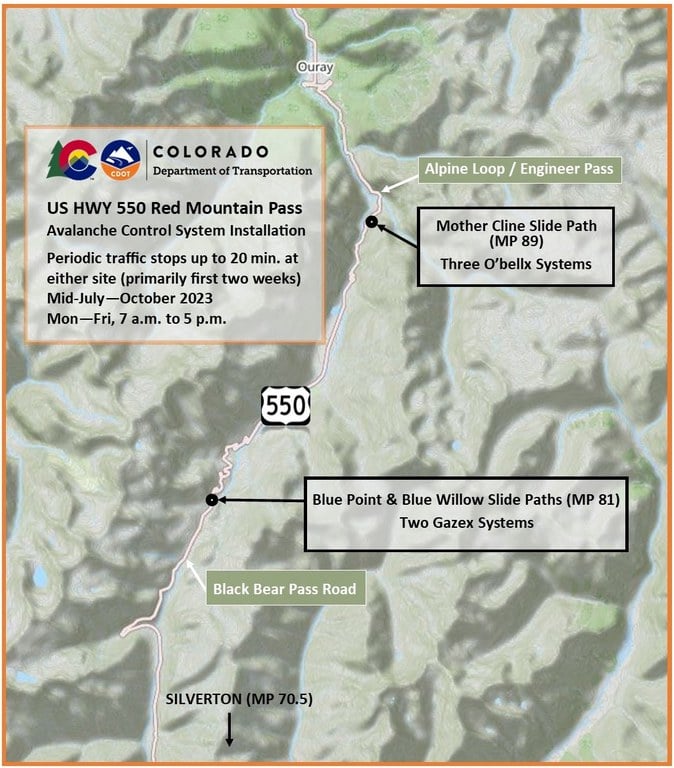
Southwest Colorado — On July 10, the Colorado Department of Transportation will begin the installation of new avalanche control equipment above US 550 over Red Mountain Pass, between Silverton and Ouray. The project will consist of installing remote avalanche control systems at three known snow slide path locations. Work will take place near the pass summit above the highway, at the Blue Point and Blue Willow slide paths (Mile Point 81), and near the Alpine Loop start at the Mother Cline slide path (MP 89). Geovert of Broomfield, CO, is the prime contractor on this project.


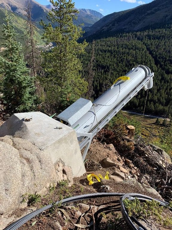
The project involves the installation of Gazex and O’bellx fixed avalanche control systems and construction of their concrete bases and control shelters. The systems operate by mixing oxygen and propane, or hydrogen gas, in exploder nozzles at the top of high-risk zones. When the gas mixture explodes, the force of the explosion is directed down toward the snow, producing a controlled avalanche.
“These are the first fixed systems to be installed on US 550, and the units are being set at the most ideal locations to more effectively trigger these known slide paths,” CDOT Southwest Region Transportation Director Julie Constan said. “As in other locations across our state’s mountain passes, the remote-controlled systems will enable more efficient avalanche control, making the areas safer for CDOT crews and travelers.”
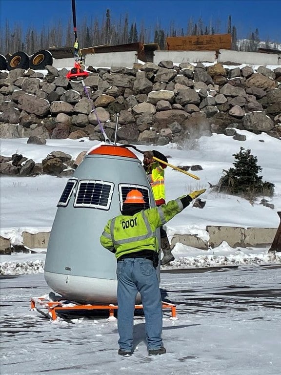
Two Gazex systems will be permanently installed at Blue Point/Blue Willow locations, remaining in place year-round. Three O’bellx systems will be placed at Mother Cline. The O’bellx base features are fixed and permanent, while the portable units holding the gasses will require resetting on site each winter with a helicopter.
The units are remotely controlled, which will reduce the amount of time spent on avalanche control missions. The new systems will also boost safety for crews who handle explosives, with methods like the Avalaunchers and the Howitzers used in other locations.
“Mother Cline and Blue Point/Blue Willow are our most active avalanche slide paths on US 550, and the Blue Point area is also a very popular spot for back-country skiers,” CDOT Maintenance Area Supervisor Vance Kelso said. “With these remote systems, we can more effectively bring snow down during peak conditions, often at night, before the sun hits the paths and hardens the snow surface. Then, we can clear the debris on the highway before morning and have things opened back up for the traveling public.”
Every winter CDOT and its sister agency, the Colorado Avalanche Information Center, regularly monitor and control some 278 of 522 known avalanche paths located above Colorado highways. The monitoring and mitigation help prevent natural avalanches from impacting public travel. When there is a high risk of avalanche danger, CDOT will close highways at the locations of the avalanche paths in order to conduct avalanche control operations. While the road is closed to any traffic, avalanches are triggered. Maintenance crews with heavy equipment then clear the highway of any snow and debris that reached the road. The highway can then be re-opened for safer public travel.

Travel Impacts
It is anticipated that travel impacts will occur primarily in the first two weeks as equipment is being mobilized to the site. Then travel will be impacted periodically, as necessary, for rockfall mitigation or other work-site activities.
Anticipated initial travel impacts:
- All work will be done from 7 a.m. to 5 p.m., Monday through Friday (some weekend work may be scheduled)
- Tuesday, July 11: At MP 81, there will be full traffic holds that could last up to 20 minutes, then traffic queues will be cleared in each direction before the next hold
- Wednesday-Friday, July 12-14: Periods of single-lane, alternating traffic; and full traffic holds of up to 20 minutes are possible
- Monday, July 17: At MP 81, full traffic holds of up to 20 minutes during morning hours; then full traffic holds at MP 89 (9 miles north of the summit) in the afternoon
Travelers should consult cotrip.org for weekly updates on traffic impacts resulting from this work. Those interested may also contact the project team to receive weekly email updates.
Project Contact Information
For additional information about this project, contact the project team.
- Project webpage: www.codot.gov/projects/us550redmtnavalanchecontrol
- Project information hotline: 970-708-2559
- Project email: [email protected]
Know Before You Go
Travelers are urged to “know before you go.” Gather information about weather forecasts and anticipated travel impacts and current road conditions prior to hitting the road. CDOT resources include:
- Road conditions and travel information: COtrip.org
- Download the COtrip Planner app: bit.ly/COtripapp
- Sign up for project or travel alerts: bit.ly/COnewsalerts
- See scheduled construction lane closures: bit.ly/laneclosures
- Connect with @ColoradoDOT on social media: Twitter, Facebook, Instagram and YouTube
Remember: Slow For The Cone Zone
The following tips are to help you stay safe while traveling through maintenance and construction work zones.
- Do not speed in work zones. Obey the posted speed limits.
- Stay Alert! Expect the unexpected.
- Watch for workers. Drive with caution.
- Don't change lanes unnecessarily.
- Avoid using mobile devices such as phones while driving in work zones.
- Turn on headlights so that workers and other drivers can see you.
- Be especially alert at night while driving in work zones.
- Expect delays, especially during peak travel times.
- Allow ample space between you and the car in front of you.
- Anticipate lane shifts and merge when directed to do so.
- Be patient!
Download the COtrip App!
The new free COtrip Planner mobile app was designed to meet the growing trend of information on mobile and tablet devices for the traveling public. The COtrip Planner app provides statewide, real-time traffic information, and works on mobile devices that operate on the iOS and Android platforms. Visit the Google Play Store (Android devices) or the Apple Store (iOS devices) to download!
